Today I participated in a guided hike to see the bison, or as most people call them buffalo, at Prairie State Park. The guide was very informative and the hike very short so when we reached the bison and the guide turned back to the visitor center, I and a few others continued on down the trail.
I did not get close to the bison as that can be very dangerous but I kept them in sight and continued on the path that went to the west and curved around and came up north of the visitor center. Eventually I came to a road which lead back to the parking lot.
This is mostly a grass trail and during the rainy season could be very wet and possibly be tick infested. I would rate the trails as easy.
Overall, it was a nice day to get outside and enjoy nature and see bison in the wild.
Because the bugs and ticks are still out and abundant this year, today I opted for a paved trail. In the All Trails app this is called the Fulbright Spring Greenway and rated an easy 7.9 mile trail.
At the trailhead, there is a descent sized parking lot and port-a-potties. There is also a little swing set and a bench so the kids can play and the adults can rest awhile. This trail does allow bicycles and everyone I met today on bikes were courteous and gave warning when they were approaching. A little way in, you will come to a fork in the road. I went right on the David C. Murray Trailhead (2.78). Most of this trail is shaded. There are a couple of creek crossings so if it has recently rained, you may have to cross water. There are also a few small inclines on the path I traveled today but nothing too strenuous. This trail does travel along side a shooting range so pay attention to the signs and do not follow the path into the range.
When you reach the Retiree Bridge, keep to the left and enter what used to be the Fulbright Landfill. You will eventually reach another trailhead and I followed the Ritter Springs Trailhead (1.85) until I reached the stop sign at Farm Road 88. There was quite a bit of traffic today so I didn’t want to walk on the road and I turned back at this point.
When I reached the intersection of the David C. Murray Trailhead and Truman Elementary Trailhead, I followed the Truman Elementary Trailhead until I reached the housing development. This was about a mile or so and then I turned around and went back to the parking lot.
The trail was fairly busy today with people walking dogs, people running, and others just out enjoying a walk. All in all, this was a very nice walk and should I need a paved trail in the future, I will come back and maybe start at the Ritter Springs Trailhead.
I visited Dogwood Canyon today. Due to all the rain in the area recently, a lot of the trails were closed or muddy so I opted for a paved trail and Dogwood Canyon did not disappoint. This trail is about 3 miles from the start to the end. There are a few dirt trails that lead off the paved path but I wasn’t able to travel on them during this trip.
All the falls in the park are manmade. You can rent bicycles instead of walking on the trail if you choose. Or there is a tram that will take you from the front to the back of the park and also through other parts of the park that are unavailable for walking or biking. All in all it was a nice trail. At the end of the paved trail where the turn around is, there is a waterfall with yellow trout in it. This is a very popular spot on the trail. This part of the trail is on the Arkansas side so you can say you walked from Missouri to Arkansas all in one day.
I was able to get about 7 miles in for the day.
At the entrance of the park, there is a museum that has interesting items on display. There are a couple of bathrooms along the trail. During the busy season, there are places to get food along the trail as well. There is an entrance fee to get into the park.
I hiked all of the trails at the Ruth and Paul Henning State Forest near Branson, Missouri to celebrate Trails Day and as a part of Earth Day week.
It was a very easy trail to visit the lookout tower, which I only made it part way up due to my fear of heights, and then I did the Red, Yellow, Blue, and Orange trails (basically covered every trail there.) Most of the time the trails were easy and then there would be that little bit that was more moderately challenging due to the rocks and tree roots, not to mention the elevation.
I saw several small waterfalls at various places. The trails were mostly clear other than a few spots that were wet due mostly to the water runoff from underground which made the trail a little muddy. I was able to see a few spring blooms but nothing real exciting stood out. The butterflies were probably the best part for me.
Originally I went here to hike the Turkey Pen Hollow Trail but it was closed due to a controlled burn. So I took in some of the other trails and still managed to get in about 6 miles. When coming into the park at the main entrance there is a bathroom at the visitor’s center.
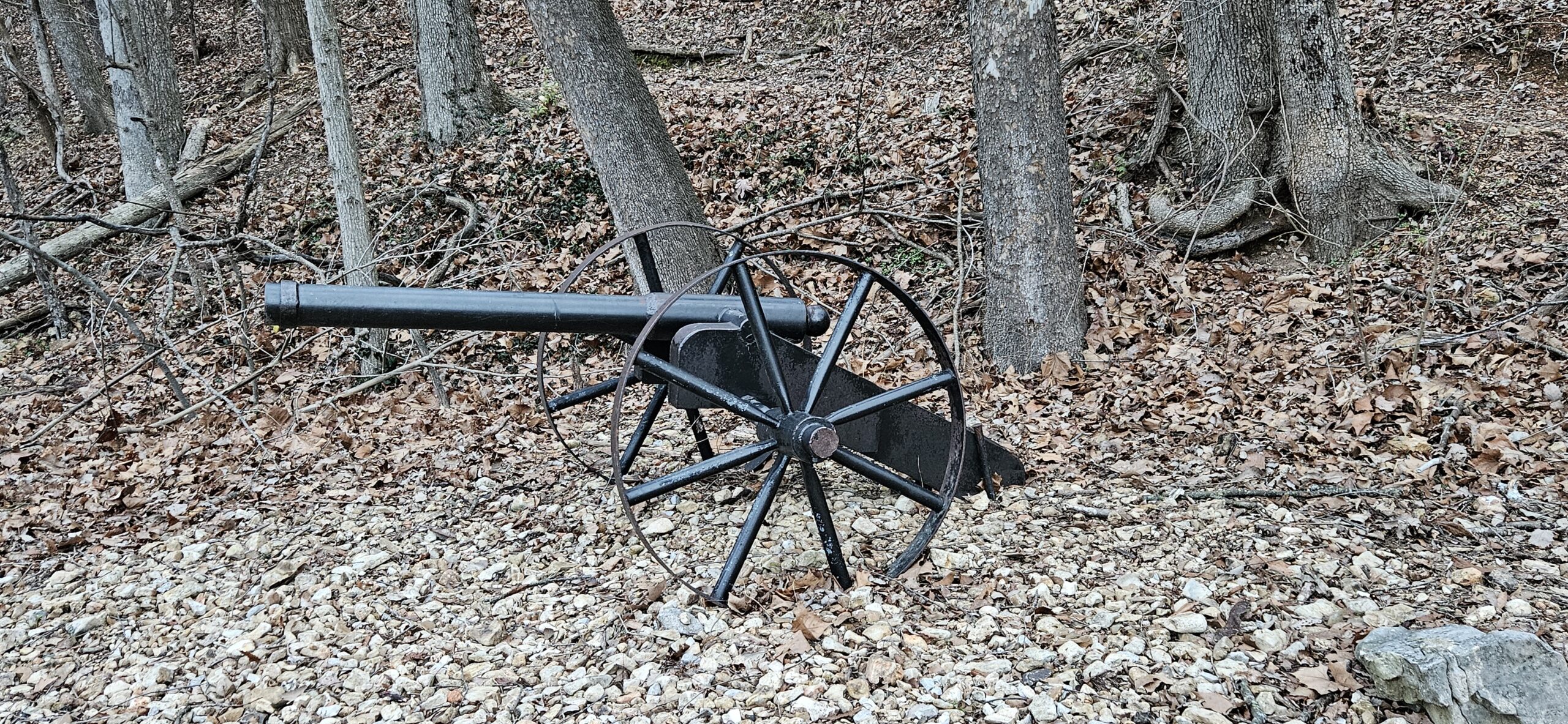
On the Dell Rim Trail you can climb the stairs and see the water tower structure which is the only thing still standing after it was burned. I followed the yellow trail (Colosseum Trail) around and saw the natural bridge and then moved over to the Carriage house and Castle ruins. Then I followed the Quarry trail around until I came to the red trail and followed it back up to the parking area.
Then I drove over and parked by the Post Office. (There is a outhouse style bathroom here). In the shelter there are game boards burned into the table tops.
I followed the Springs trail around and then down to the water and passed the Island Trail. This trail appeared to climb straight up and there were several people on it at this time so I just followed the blue then white trail back up to the parking lot.
Overall it turned out to be a very nice hike/day. There were a few wild flowers but still very few leaves and not much color. The trails varied from easy to moderately hard. There were a few steep spots and stairs but overall a very nice day.
When I arrived, which was just after sunrise, there were only two other cars in the parking lot. When I finished, and got back to the car, the lot was pretty much full. I never did see anyone on the way down, and only started seeing people when I was starting back up.
It is rated a hard trail and but it was pretty easy to navigate. It wasn’t well marked but the trail to the waterfall was well used so I had no trouble finding it. There are a couple of signs along the way to help with direction.
On the way down, it will be narrow in spots, rocky, and tree root covered but there are also stone “steps” that will help with some of the gravity as you will be descending about 1400 feet. It is so hard to describe the magnitude of the waterfall. Even though it was only a trickle the day I was there, the sheer size of it and the beauty is so nice and because I was there alone, so very peaceful.
On the way back, I decided to follow the trail down to the river. It only added another 1.4 miles or so to the original 5 miles. The river trail is relatively easy. The river was mostly dry the day I was there so I was able to walk out into the center and across it. It too was very pretty.
The fall colors added to the beauty of the entire hike. The hike back to the top did get me out of breathe a couple of times. The steps did help with the ascent. I did have to crawl over a few downed trees and over a few rocks but overall a very nice hike and well worth the drive.
To find the parking lot, which is very small, you will see a sign that says No Parking, look just to the right of this sign and you will see a small driveway. This will lead you to the parking lot. It isn’t very big but this seems to be a popular trail so I would arrive early if possible.
This is rated a hard hike but until you reach the Goat Trail it really is pretty easy. You will be going down and walking on rocks and tree roots. There are a few times when you will crawl over or until a downed tree but this was a great fall hike and the colors were so pretty.
When I reached the intersection of the Center Point Trail and the Goat Trail I did use the AllTrails App to see where I was. There really isn’t any markings along the way but the Goat Trail is very popular and the path is well worn. Just stay to the right to find the path. Once on it, the trail will become a little more difficult, steep, narrow, but beautiful.
I was able to see the river below once I reached the rock cliffs. The height of just how far up you are and the distance you can see is just remarkable.
The walk back to the car really wasn’t very difficult but this is when I started to encounter more visitors. While at the rocks, I only saw one other person.
It was a beautiful day to be out hiking in the woods. January 1st is “First Day Hike” and I decided to visit Neosho, Missouri. Although the High Ground Bike Preserve is a designated bike trail, hiking is allowed. I was the only one on the trail today until I was leaving and then others were getting on the trail.
I started at the main trailhead in the park area. I hiked counterclockwise and therefore did the Homestead Loop first. The trails were mostly dirt and smaller rocks. Once in a while, there would be a tree root to watch out for. The trail isn’t really marked but it is well worn and easily followed. I kept coming across, “DO NOT ENTER DOWNHILL AREA” signs and couldn’t figure out where they started so I could travel down. About half way around, I came to a second parking area and that is the trailhead for the Rough Rider Ridge Trail.
I did see many gray squirrels and a couple of deer while on the trail. If you start and go right, not to far down the trail you will see the ruins of a couple of buildings. Keep following the Homestead Trail and eventually you will come upon the ruins and be able to get a closeup view of them. If this was a house at one time, I would have loved to live there. You are up on the top of the ridge and can see a great distance. It would have been a beautiful view each day.
Beginning at the ruins, I started to see candy canes placed along the trail. That was a nice addition to the scenery. At times you will travel through the woods, then you may come to a clearing, or the area may become more bush than tree. It appears that there may have been a fire in the area as many of the trees had burn marks. You can also tell that at some point, there had been wind damage because there were several trees that had fallen and the trail had been cleared. I also found a lawn chair at the bottom of a ravine; in one area there were several tires just randomly placed, which was odd; and then a can just off by itself. Seeing these items in what seemed like random places makes you wonder how they got there because it would not have been an easy task to get them there. There were also old concrete chunks in odd places and a “junk/trash” pile.
After I completed the intended loop and because I was the only one on the trail, I decided to go up one of the DO NOT ENTER areas to see if I could find out there the downhill begins. I went up the La-Z-Boy Downhill and came to the area where it and the Gone Rogue and Wildcat Chase trails begin. I still couldn’t figure out how I missed seeing this area so I followed a trail that led up to them and ended back up on the Homestead Trail. (At the intersection where you can go right and stay on the Homestead Trail or go left on an unmarked trail, follow the unmarked trail and it will take you to the beginning of the downhill trails.)
This wasn’t the most exciting trail but I enjoyed every minute because it is a moderately hard trail and you will get a workout with all the ups and downs.
The Morse Park is rather large and it does seem to have lots of paved trails to walk as I saw several people walking their dogs. There are play areas, a fishing area, a skateboarding area, and several ball parks. I have a feeling that in the summer this park is very busy. I did see restrooms but I do not know if they were open.
Overall, a very nice trail and I will be returning when the ground is too wet to walk the dirt trails and see where the paved trails lead. This was a great way to start the new year.
Today I hiked the Pike Hollow Trail which is rated a moderate trail but I really didn’t find it to be very difficult. It started out in mowed grass, then dirt and some rocks, with very few inclines. The spider webs were HORRIBLE and I felt like a mummy wrapped in webs. It wasn’t the most exciting trail but it was nice to get out and explore another area. I did manage to scare up a wild turkey, racoon, turtle, squirrel, and a deer. There was a small creek crossing a couple of times but it was easy to cross without getting wet. For the most part it was a completely shaded trail. It did have a few outcroppings and an overlook area.
Soon after the trail starts you will see the Pinwoods Trail but keep to the left and follow the Pike Hollow Trail. A little later you will come to a white trail. This is the connector trail and is a very easy dirt trail. I followed the Pike Hollow Trail and about half way around you will come to the white connector trail again. When I reached this point, I did follow the white trail down and back up just to say I had covered it too. Then I continued on the Pike Hollow Trail. Toward the end of it you will connect with the Pinwoods Trail. I kept to the left and followed it to the end. Then I was back at the beginning and walking the gravel Pinwoods Trail.
It was a somewhat eerie feeling when the first sign you see is to be bear aware. Luckily I didn’t see any. The Pike Hollow Trail is about 4.5 miles and the Pinwood Trail is about .6 miles. It took me 3 hours to hike the Pike Hollow Trail and that was mostly due to the fact that quite often I had to stop and remove the cobwebs and spiders from me. The Pinwoods Trail only took about 11 minutes.
On the drive down and back, I did see a couple of deer, a rabbit, racoon, fox, and squirrel.
At the start of the trail there are a couple of picnic tables and a primitive restroom.
I have a few more photos from these trails on the Facebook page
The plan for today was to hike the Turkey Pen Trail, but when I arrived I discovered that there was a little nature trail at the parking lot and the Acorn Trail and the Devin’s Kitchen Trail all were within the circle of the Turkey Pen Hollow Trail so I decided to hike them all. In total that put me at about 10 miles for the day.
It was a beautiful day. The temperature was 30 – 40 while I was out. There was a little breeze once in awhile that was cool but overall, very pleasant temperatures for hiking.
I saw two people at about the 3.5 mile marker and then at about the 6 miles marker I came across a single person on the Turkey Pen Hollow Trail. Other than these encounters, I had the trails to myself. At times you will be far enough away that you won’t hear any traffic. Because of the time of year, I heard very few birds. I did come across a deer on the Acorn Trail and a doe and fawn on the Devin’s Kitchen Trail. A few squirrels were here and there on the trails.
The Turkey Pen Hollow Trail does have controlled burning at times so this was my second time to try and hike it. If it is closed, the parking lot will be marked off so parking is not allowed. If this parking lot is full, there is another parking lot to the right and one to the left that you may be able to use.
There is a visitor’s center at the entrance of the park that has a bathroom. Or at the end of the Devin’s Kitchen Trail there is a primitive bathroom and picnic shelters.
This park is very popular so planning ahead for crowds is advised.