After hiking the Twin Knobs Trail today, I decided to return home via a different route and stopped at the place where Arkansas, Missouri, and Oklahoma all intersect and depending on which side of the marker you are standing, you can be in a different state. There is a gas station on the east side of the road and the marker is on the west side. You will need to park at the gas station if you want to get up close to the marker. This area is very busy so be careful when crossing the road. The marker isn’t very big but it was something different to see while I was in the area.
The marker is located on Arkansas 43 near Sulphur Springs, Arkansas and McDonald County Missouri.
I have known about the Route 66 Mother Load Road all my life but have taken so many of the historical or interesting stops or granted. Today, I decided to travel from Tulsa to Vinita Oklahoma and check out some of the sights along this famous road. #route66
The first stop was the Center of the Universe which is just off the Route 66 path but because I was in the area, I decided to stop. The center is located in downtown Tulsa by the Tulsa Union Depot on Boston Ave. The Depot was closed but still a very interesting building. The artificial cloud is also here and is standing beside the center of the universe. When standing on the circle or the center of the universe, if you say something it will echo back to you. It was very interesting and I’m amazed that it could happen without any walls around you. If you have a minute and are in the area, stop in and experience it. #centeroftheuniverse
The next stop was Route 66 sign on southwest boulevard. At this location, there is history about what was once Crystal City which in the day was an amusement park and area for entertainment. From if you travel east, you will come to the Historic Red Fork District. I did stop and take a photograph of a mural but that was all today. I traveled on east to Tulsa’s Route 66 Historical Village. This is a very interesting stop but was closed during my visit but I was able to walk around and see the train, gas station, trolley car, and oil derrick. This oil derrick here is the tallest in America. #historicalvillage #crystalcity #oilderrick
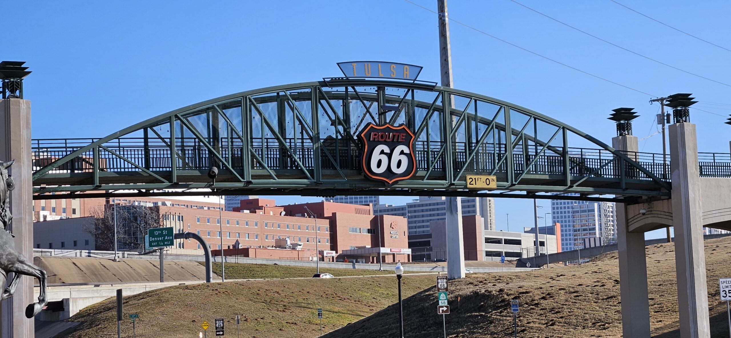
Traveling on eastward, I came to the Cyrus Avery Route 66 Memorial Bridge which is where east meets west on this route. Here the landscape beings to change and the road stretches out in anticipation of the journey to California. At this location there is a pedestrian and bicycle bridge that allows easy crossing of the highway. #cyrusavery
East of here I made a quick photo stop of the Meadow Gold sign, mural, and various statues. This is a very popular area. The next stop was the Ark of Catoosa and the Blue Whale of Catoosa. The ark is in disrepair but I’m sure at one time, it was fun to children to play in. The blue whale allows visitors to walk out on the water. #meadowgold #bluewhale
The H. Tom Kight Jr Bridge is the entrance to the Molly’s restaurant and today the restaurant was closed so I wasn’t able to go across it.
Next stop was the Totem Pole Park. This park is home to the largest concrete totem pole. There were several totem poles here and all sides of each pole was different and each pole represented something different. This too was closed today so I wasn’t able to visit the information center or gift shop but still worth the stop to see all the art work. #totempolepark
After the Totem Pole Park, I did stop and snap a photograph of the old gas station that was in town and then it was on to the Hi Way Café in Vinita for lunch. The food was great, as well as the service and atmosphere. Here you will find a car that has been stickered. Which means that the stickers were small, 66,000 of them, and they created the painting on the car. The car in inside the restaurant and well worth a stop to see. Outside the restaurant is another car the public is allowed to put stickers on if they choose. #hiwaycafe #vinitaoklahoma
There is still more to see along the route but this was a full day.